Infrastructure technology
Every day Norway
digs blind.
Landmarker builds systems that give infrastructure owners and operators verified knowledge, real-time awareness and documentation that holds up. From planning to operations.
For infrastructure owners
Protect what you own.
Sensor monitoring, location and real-time awareness for municipalities, energy companies, telecom and water utilities – with documentation that holds up to inspection.
Does this sound familiar?
The map doesn't match what's in the ground
Old records and uncertain positions lead to excavation damage that could have been avoided.
You hear about the digging after the damage is done
Without alerts, you only notice activity near your network when it is too late.
The regulator asks for documentation you have to hunt for
NIS2 and the Norwegian Digital Security Act require traceable incident handling.
The solutions
Four modules. One platform.
Start with what you need. The modules share data, so everything you add makes the rest better.
DAS monitoring
Perimeter security
Continuous monitoring along critical fibre routes. Automatic alerts on activity, powered by our own algorithms.
Read more about perimeter securityVerified position
Asset location
From uncertain maps to verified positions. We find infrastructure in the ground when the map is wrong.
Read more about asset locationReal time
Real-time awareness
An operational map of activity near critical infrastructure. Incident log for NIS2 reporting.
Read more about real-time awarenessFor inspections
Documentation
Traceable, verifiable documentation, available when the regulator arrives.
Read more about documentation
The platforms
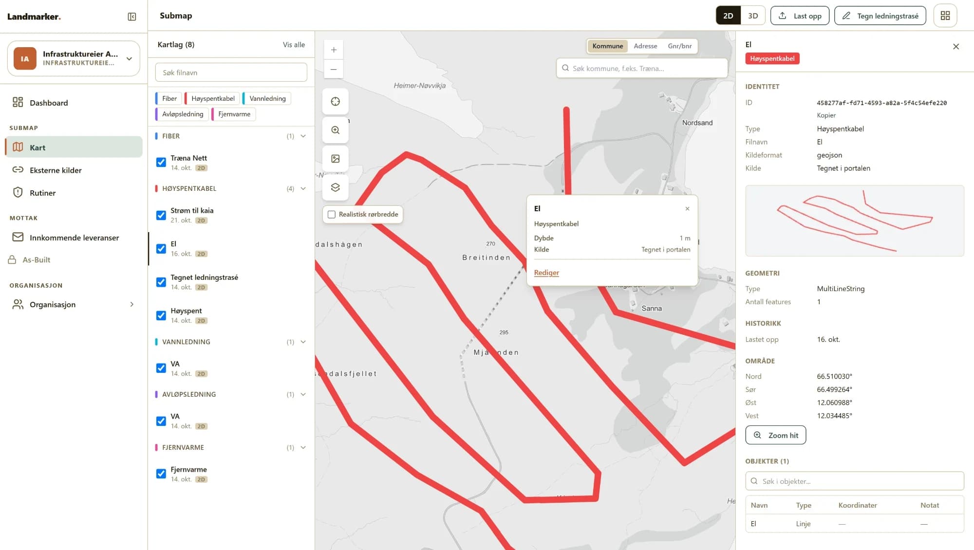
All your lines on one map.
Fibre, high voltage, water, sewage and district heating as separate map layers – with filters, search and full history.
What you use as an infrastructure owner
 The Landmarker portal (opens in a new tab)
See your whole network in Submap, receive As Built deliveries from contractors and connect the data to your own systems.
 graveinfo.no (opens in a new tab)
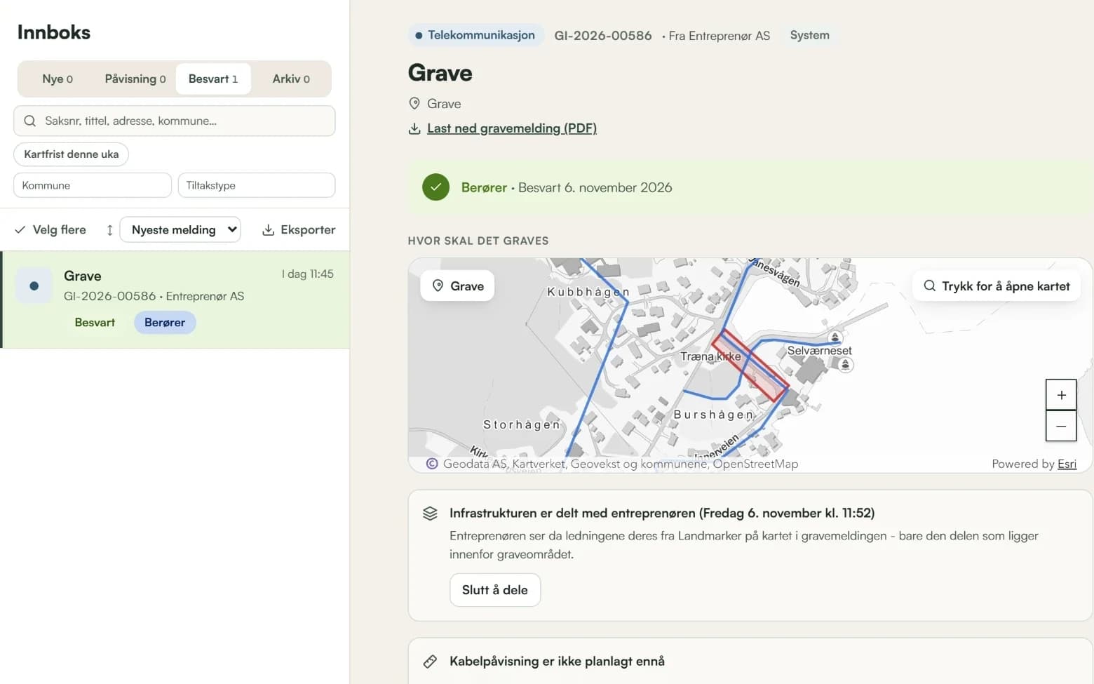
Register your area of responsibility and answer dig notifications from contractors.
 jarð (opens in a new tab)
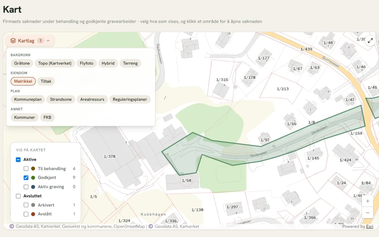
For municipalities: handle dig permit applications and coordinate digging in the municipality.
3,000+ infrastructure owners and several municipalities use graveinfo.no today.
Get started
Three steps to an overview.
Register in graveinfo.no
Free of charge. Registration takes 2 minutes.
Upload map layers and coverage area
Contractors in the area can see who owns the lines.
Add modules when you need them
Perimeter security, asset location or real-time awareness in the Landmarker portal.
NIS2 and the Digital Security Act
Documentation that holds up to inspection.
Owners of critical infrastructure must document security and incident handling. Data is hosted in data centres in Norway and Germany and never leaves Europe.
The incident log shows every answer, every share and every location – with the time and who did it.
Talk to us about NIS2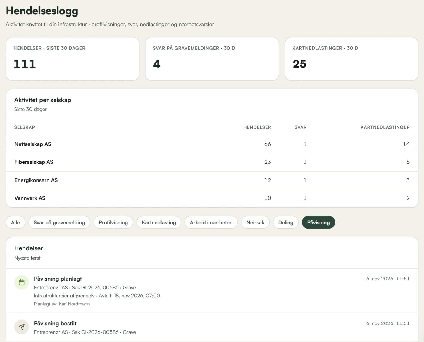
Talk to us.
Municipalities and infrastructure owners
Emil Hasund Eid
COO & Founder
Contractors
Jarle Nyhus
CEO & Founder